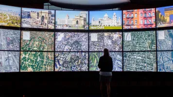
Datavized is an immersive visualization platform that makes it easy to turn complex data into fully interactive web experiences. Datavized’s geodata software products provide users with a web-based drag and drop tool to effortlessly turn spreadsheets into fully interactive 3D maps for enhanced visualization, analysis and decision making. Datavized works on all platforms and connected devices; including desktop, mobile, tablet, and with virtual reality, augmented reality and mixed reality headsets, enabling users to tell immersive data-driven stories.
Geodata Products
Datavized software products provide users with efficient, easy-to-use, three-dimensional geospatial templates for mapping global, national and city data visualizations. Datavized makes it easy to run rich 3D geospatial data as fully interactive visualizations live in web browsers and integrate spreadsheet data for analysis and presentation. The tool enables users to easily turn CSV, XLSX, and geographic data structures into fully interactive and immersive data visualizations.
Technology - Powered by Datavized
Datavized builds simple tools for complex data; turning information into fully interactive, web-based presentations. Combining the immersive power of virtual reality with the seamless delivery of the mobile web, the software enables cross-platform collaboration and enhanced decision making. Datavized has spent 3+ years building a robust proprietary stack of custom code components on top of the standard libraries and APIs that allow rapid implementation of virtual reality (VR) content following best practices for VR, with specific consideration for the unique onboarding experience of VR for the web.
Priorities as a partner of the Global Partnership for Sustainable Development Data
As a leader in immersive visualization technology, Datavized will provide platform tools for monitoring and visualization of sustainable development goals data. Global, country, and city geospatial templates will address the needs of developing countries and provide global partners with capacity-building tools to map datasets on the open web and strengthen interoperability standards and protocols. Datavized cross-platform geospatial data and analysis tools will allow new ways of experiencing data through accessible web-based collaboration, and contribute to innovative data adoption and methodologies using VR, augmented reality and mixed reality to help better understand and communicate the most pressing issues.
To achieve the goals; from building sustainable cities and communities, to economic growth and climate action, Datavized immersive web visualization tools will build new behaviors in users, moving from merely analyzing data to experiencing information in more visceral ways to better understand the complexities, ask better questions and make better decisions. Datavized is committed to sharing our expertise and solving real-world problems to support the Global Partnership for Sustainable Development Data.

