Cities are engines of sustainable development. Over the last seventy years, the share of the world’s population living in urban areas increased from 30% to 56%. By 2050, an additional 2.5 billion people are expected to live in cities, mainly in Asia and Africa. These cities are economic powerhouses, generating around 80% of global GDP, and are centers of political activity, innovation and economic activity.
Yet cities across the globe are also home to some of the greatest inequalities. Climate change is a growing threat and is exacerbating inequalities in urban areas. Natural hazards are one such climate-related challenge and have been steadily increasing since the 1940`s. Looking ahead, the frequency of natural hazards is only likely to accelerate, wreaking destruction across cities and rural areas alike, impacting food security, and causing major economic losses globally.
The impact of a changing climate for city dwellers is far from uniform, even within cities. The poorest urban residents often live in the most vulnerable areas in cities, where housing conditions are inferior and where services are not provided adequately. These city dwellers often lack the means to recover from economic or environmental shocks and stresses. As natural hazards in urban areas look set to continue growing in frequency and intensity, the most vulnerable city dwellers are being left increasingly exposed to climate change-induced hazards.
In the face of these growing challenges, investing in urban resilience is key in tackling inequality and driving sustainable and inclusive urban development. Cities need the tools and knowledge to plan for and mitigate the adverse impacts of disasters and climate change, and reduce vulnerabilities for all.

The role of geospatial data
Geospatial data can play a critical role in supporting more resilient urban planning. Accurate and timely geospatial data and the necessary tools to convert it into meaningful information for decision making can be transformative for cities, and help in protecting the most vulnerable from natural hazards.
The City Resilience Program (CRP), established in 2017 as a partnership between the World Bank and the Global Facility for Disaster Reduction and Recovery (GFDRR), offers one such example of how geospatial data can be used. CRP works with city governments to build greater resilience to climate and disaster risks through the City Scan tool––a tool consisting of a series of maps, visualizations and analyses that describe a city’s key resilience challenges.
The City Scan offers a starting point for more informed decision making and long-term planning around investment decisions, by showing insights such as:
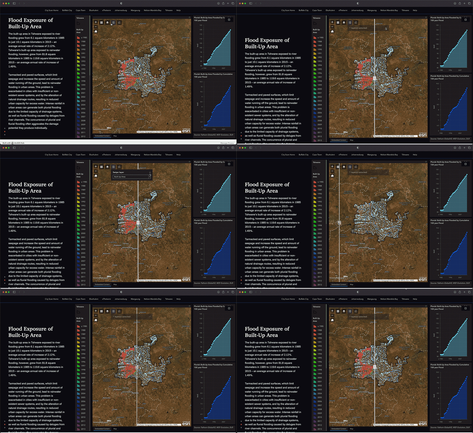
- The spatial distribution of built-up area and population exposure to flooding
- Localized measure of air quality
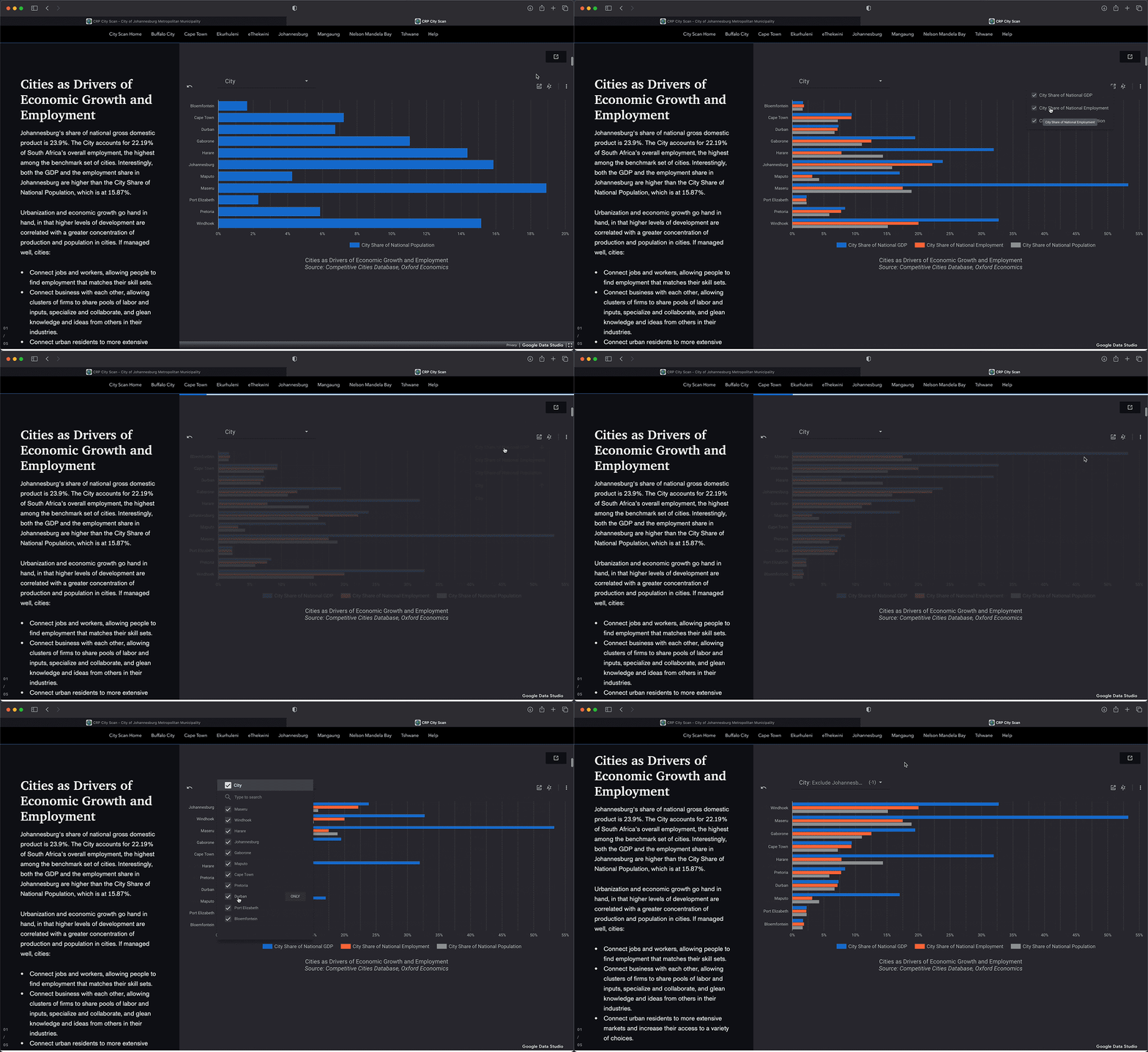
- Hot spots of economic activity
- Transportation networks and road criticality
- Solar power potential
- Accessibility to urban parks and gardens
- Spatial trajectory (urban expansion).

Building city resilience and the role of interactive storytelling
Tools like the City Scan are a useful building block, but how can we then turn complex geospatial data into clear, accessible and convenient information for decision makers? Unpacking geospatial data in ways that feel intuitive and accessible is a central part of the solution. Esri's ArcGIS StoryMaps is one platform that allows this, creating inspiring, immersive and engaging stories through combining text, interactive maps, and other multimedia content.
Working with the CRP team, New Light Technologies Inc. has leveraged StoryMaps to develop a dynamic and user-friendly way to map the resilience of cities around the world to natural disasters and climate change––piloting this approach through mapping climate resilience, planning, investment, and asset management in South African metropolitan municipalities.
The StoryMap incorporates data layers relevant to resilience planning and allows users to explore how phenomena are related to each other, for example:
- How does urbanization affect exposure to flooding?
- How is the distribution of green spaces in a city related to Urban Heat Island?
- How did economic activity change in and around the city in the last 10 years, and how is this related to infrastructure investments?
The StoryMap was designed to encourage people to interact with the data; explore it, zoom in and out, navigate between locations, examine spatial relationships and query the maps. It also acts as a channel for leveraging local and expert knowledge––policy and decision makers are able to propose potential areas for investments in infrastructure, respond to others’ ideas and suggestions, and discuss ideas on sustainable urban investment.
In an era of climate change resilient, we need new tools and ways for cities to leverage data in planning for a more resilient future. ‘Thinking spatially’ is a key ingredient for resilient planning to help track the complex relationships between complex urban forces that affect resilience. Spatial insights are the future for evidence-based, risk-informed urban policy making.
Want to find out more? Get in touch with New Light Technologies and get in touch with the CRP.


