As part of the Data Roadmaps for Sustainable Development process, the Global Partnership for Sustainable Development Data has engaged with several countries, a consistent need articulated by most countries was data gaps on environmental issues, and limited capacity on integrating geospatial and earth observation (EO) data with national statistical accounts to address the Sustainable Development Goals (SDGs). The Group on Earth Observations (GEO) has been a key Anchor Partner within the the Global Partnership, supporting the country-level data roadmap process on methods and tools available through the GEO network to address these challenges. Through this engagement, the National Aeronautics and Space Administration (NASA), with GEO, stepped forward providing its resources and expertise to more directly engage with Global Partnership partner countries on meeting key data gaps and challenges where earth observation data could be applied to the SDGs.
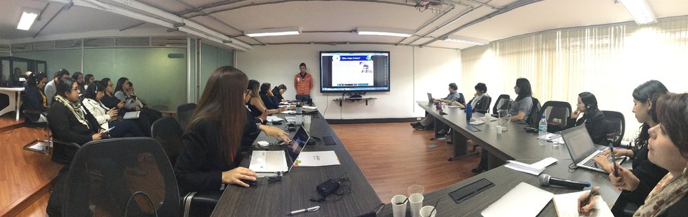
Together with NASA and the Colombian National Administrative Department of Statistics (DANE - Departamento Administrativo Nacional de Estadística), the Global Partnership co-organized a workshop in Bogota, Colombia ‘Towards Integration of National Statistics and Earth Observations for SDG Monitoring.’ Based on a set of iterative discussions with DANE in advance, this workshop was designed to bring together key agencies and stakeholders in Colombia working on these issues (over 30 participants in total) including DANE, Ministry of Environment and Sustainable Development (MADS) and the Institute of Hydrology, Meteorology and Environmental Studies (IDEAM), with international partners including NASA, GEO, University of Maryland, European Space Agency (ESA), Committee on Earth Observation Satellites (CEOS), and the World Bank, to further identify gaps where existing or EO-based methods that could be piloted to address these challenges. Identified SDGs for focus included Goal 6 (Clean Water and Sanitation), Goal 11 (Sustainable Cities and Communities), and Goal 15 (Life on Land).
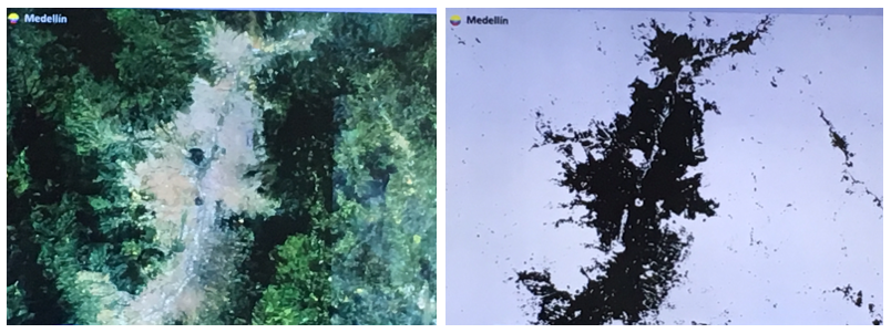
Colombia is already quite advanced on the use of EO data for the SDGs and has established an inter-agency coordination mechanism on data needs for the SDGs. In fact, several of the international partners had on-going collaborations with MADS and IDEAM. This workshop provided an opportunity to have a deeper level of engagement across agencies to identify where further collaboration could be developed to address these data challenges and highlighted the importance of institutionalizing multi-stakeholder mechanisms for collaboration against the SDGs. The Government of Colombia was able to demonstrate the work conducted thus far on Indicator 11.3.1, Ratio of land consumption to population growth, and its application across 151 cities in Colombia, using Landsat data and the Google Earth Engine platform to optimize processing and classification of images. They further presented ongoing work and progress in areas related to open space, rural populations, biodiversity, and soil degradation. To complement these, and identify additional areas of collaboration, the international partners presented on methods for land use and land cover change, water ecosystems, forest management, automated methods for delineating urban areas, integration of optical and radar imagery, the use of data cubes for analysis ready data, and a developing National Spatial Data Infrastructure (NSDI) program in Colombia.
The outcomes of this workshop will be used to devise a national timeline with milestones and deliverables on these products that will contribute towards Colombia’s monitoring and achievement of the SDGs. The aim is to be able to apply this approach in several countries with the intent of scaling successful pilots and methods across multiple countries. The Global Partnership would like to thank all the involved organizations for their invaluable inputs, particularly DANE, GEO, and NASA.