Images from space have enormous capacity to improve policy and decision-making, especially in countries with significant gaps in traditional data. However, many nations, particularly those in the global South, face practical challenges to use these data for decision-making.
To address this challenge, the Global Partnership for Sustainable Development Data (Global Partnership) created a systems-based approach as part of our national capacity building initiative to help country partners increase proficiency in the use of Earth Observation (EO) data, tools, and services.
What is Earth observation data?
Satellite EO platforms and data are derived from coupling images at different spatial resolutions (e.g., from satellites or airborne drones) with geospatial tools to strengthen environmental monitoring and forecasting. These tools are crucial for public sector decision-making—with applications ranging from food security, environmental resources management and disaster mitigation, to economic growth and sustainable urban planning—especially where environmental data collected by more traditional means are lacking.
Funding from the Islamic Development Bank enables our work to promote the use of EO data in national data systems.
This case study shares this approach in practice in Guinea, Mali, Somalia, Suriname, and Togo. In these countries, our approach involved three steps. First, (1) we conducted consultations, peer exchanges, and needs assessments with country partners to understand the challenges and barriers they face in accessing and using EO data to inform decision-making. (2) Using this information, we collaborated to help countries acquire the underlying technical know-how and expertise required to set priorities and strategies using data. Finally, (3) we established collaborative partnerships to assist nations to deepen their newfound knowledge and apply it to existing issues.
Phase one: Identifying common challenges in using Earth observations
During a series of peer exchanges and webinars with country partners and technical partners, common themes that pointed to reasons for the limited uptake of EO data emerged. These included a lack of technical infrastructure, limited capacity in EO software skills, and the requirement for expert processing and analysis of EO data into statistical indicators, a process also prone to software errors or human misinterpretation.
For example, a peer exchange in July 2022 convened 15 participants from institutions in Ghana and Suriname to share knowledge and experiences using environmental data and statistics. During the peer exchange, participants from both countries shared challenges they faced in obtaining and using EO data, especially for developing national statistics. Ghana also highlighted ways they have worked with the Global Partnership, such as a collaboration between the Ghana Statistics Service and the Africa Regional Data Cube which helped build capacity for Ghana to apply EO data to address various environmental monitoring needs. This in turn, helped Suriname to solidify their priorities for engaging with the Global Partnership.
Developing countries have similar challenges in monitoring the environmental impacts of climate change and human activity. The lessons learnt from both Ghana and Suriname provide opportunities for collaboration on the use of EO and evidence-based decisions for policymaking.
Needs assessments with environmental data stakeholders in Guinea, Mali, Somalia, Suriname, and Togo also confirmed what we learned through peer exchanges like that between Ghana and Suriname. The assessments confirmed that country partners view climate and environment data as crucial for decision-making, including for monitoring weather and climate variability, real-time agricultural activity, land use and land cover mapping, water availability, and more. Respondents also confirmed that limited technical and skills capacity were factors that hinder access to, production, and use of this kind of data.

Officials from Suriname’s Foundation for Forest Management and Production Control (SBB), General Bureau of Statistics (ABS) Central Bank and National Planning Office, among others, convened for the hybrid peer exchange on “Challenges and opportunities in the use of earth observation for monitoring environmental SDGs” in July 2022.
Phase two: Building foundational capacity and national strategies
Based on the information gathered in the first phase of this project, we collaborated in the second phase with an expert in EO and geospatial data to provide virtual training to country partners in using EO data and building geospatial capabilities.
The objective of this training was to increase participants’ awareness and knowledge about the availability of open-source and commercial satellite data and geospatial technologies (required for collecting, storing, and organizing satellite imagery) and their potential applications. The training also covered the process of developing an EO strategy that delivers tangible policy results. The four-week training was tailored to participants’ differing levels of knowledge and experience with EO technology and data as well as with GIS software.
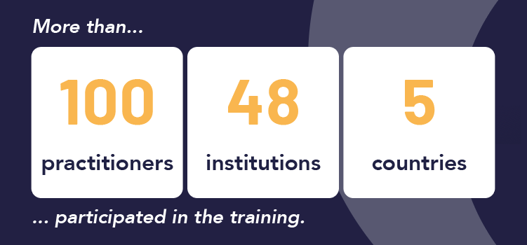
More than 100 practitioners in environmental and climate statistics from 48 institutions in five countries participated in the training. Participants identified institutional challenges to applying the training content to practical uses of remote sensing technologies and GIS, including:
- Mapping and inventory of agricultural land as a means of validating data collected during agricultural surveys to support sustainable land use management in Mali.
- Monitoring of wetlands and related ecosystems for conservation planning in Togo.
- Overseeing protected forest areas to inform policies on the protection and management of classified and/or protected areas in Guinea.
- Monitoring rangeland practices that contribute to loss of pasture (including unsustainable tree cutting for charcoal production, overgrazing, and conflicts) to improve sustainable rangeland management and food security in Somalia.

National stakeholders in Somalia attending the virtual training in Earth observations tools and data in October 2022.
After the training, 95 percent of participants reported that they were satisfied with the course, that it increased their understanding of the topic, and that it enabled them to understand how to solve a current problem in their institution.
The EO training was interesting and surely made a contribution in terms of capacity building on this matter.

Extract from the teaching material: Addressing challenges on Earth using data and insights from space (Dr. Dragos Bratasanu, eoStrategy).
Phase three: Using EO data to inform policy and action
The training enhanced participants’ knowledge and awareness of EO data, enabling them to design a workflow to address problems using the appropriate selection of EO data and analytical techniques. Members from each country are now tasked with demonstrating their increased capacity by applying it to a short-term project linked to a real-world problem they face in their work.
A potential intervention where I can apply the skills gained would be the spatial-temporal study of the classified forests of Guinea.
Beyond EO skills and knowledge, the peer exchange between Ghana and Suriname identified some of the factors needed to address long-term challenges in using new data types and sources in environmental monitoring for decision-making. These include coordination and cooperation among geospatial and EO communities, organizations, ministries, and other stakeholders, as well as increased investment in the official statistics community in EO data manipulation, interpretation, and digital skills building.
As an immediate next step, participating countries will implement their learning outputs in their post-training short-term projects, define longer-term country objectives, and highlight remaining challenges, as well as identify more opportunities for partnerships and integrations with other actors in the EO data space. Further, the Global Partnership brokered a partnership with Humanitarian OpenStreetMap Team to provide capacity-building activities in geo-data literacy and mapping in Guinea, Mali, and Togo. In Somalia, Digital Earth Africa will support national stakeholders in building EO data skills. In Suriname, plans are underway to strengthen environmental data management in the national statistics system through technical assistance facilitated by peer countries and in-person training on application of satellite data to monitor environmental indicators as well as through development of a use case on the state of the environment to inform national policy and decision-making.
The Global Partnership continues to support participating countries to scale what they have learned through the capacity building process to enhance country objectives alongside technical partners committed to working with countries to address deeper capacity gaps in EO data analysis and use.
> To find out more about training and partnerships in action, sign up to our newsletter and follow us on Twitter.
This project was managed by Francois Kamano (Francophone Africa Program Manager), Fredy Rodriguez (Senior Latin America and the Caribbean Regional Manager), and Victor Ohuruogu (Senior Africa Regional Manager) at the Global Partnership.