
This story was originally published by NASA as part of Nasa is Where the Wild Things Are.
After careful conservation efforts to bring black rhinos back from the brink of extinction, extreme weather is making it difficult to provide a habitat for them to thrive in.
For conservationists in Kenya, analysis of satellite data from the joint NASA/U.S. Geological Survey Landsat program using a tool called the Africa Regional Data Cube could provide answers.
Located in northern Kenya, Il Ngwesi Conservancy is home to the Il Lakipiak Maasai people, who set aside 80 percent of their community land to provide wildlife with protected grounds within which animals could roam freely without the threat of poachers.
Black rhinos have been critically endangered by a half century of poaching, with numbers in Kenya falling from 20,000 in the 1970s. A painstaking conservation effort has raised the number to about 650 black rhinos.
"This community knows its lands and animals," said Mohammed Shibia of Northern Rangelands Trust, which supports 39 conservancies in the region. "Where once the Maasai boys in the community would collect information on water availability and suitable grazing pastures throughout a reliable seasonal cycle, now with frequent flooding and drought this becomes an impossible task. Remote sensing can be a highly effective tool to manage great swathes of land without causing exhaustion and hardship."
Now Shibia is working with Il Ngwesi leaders, neighboring conservancies in Lewa and Borana, and local and international organizations to derive insights from satellite data and develop a plan to protect and preserve land with the preferred environmental and climactic conditions for the rhinos. The landscape being monitored is large — about 35 square miles, divided into nine grazing plots, through which pastoralist communities pass and animals roam.
The research team is using the Africa Regional Data Cube (ARDC), an initiative developed by a host of partners including the Global Partnership for Sustainable Development Data (a network of 250 organizations working to improve data for international development), NASA, Committee for Earth Observation Satellite (CEOS) and others that provides an analysis-ready platform that can be used to look back over 20 years of satellite data and identify changes in rainfall and the vegetation state of the grazing land.
Demand for satellite data by governments in low income settings is high — areas of interest include everything from identifying physical destruction of lands caused by illegal mining, to monitoring deforestation, drought conditions, coastal erosion and showing urban sprawl in growing cities over time. A coalition of international organizations is rolling out a continental wide data cube in 2020 through the Digital Earth Africa initiative. Input and feedback from the five countries using the ARDC — Kenya, Ghana, Tanzania, Senegal and Sierra Leone — helps develop products and algorithms that are shared openly as global public goods.
For Il Ngwesi, time series data analysis on changing vegetation availability over time will be consolidated into reports and shared with neighboring conservancies, partners and Kenya Wildlife Service, strengthening coordinated action and building the licensing application to host additional rhinos. There are two white rhinos onsite and the plan is to introduce 10 black rhinos in the short term, building up to an eventual population of 30.
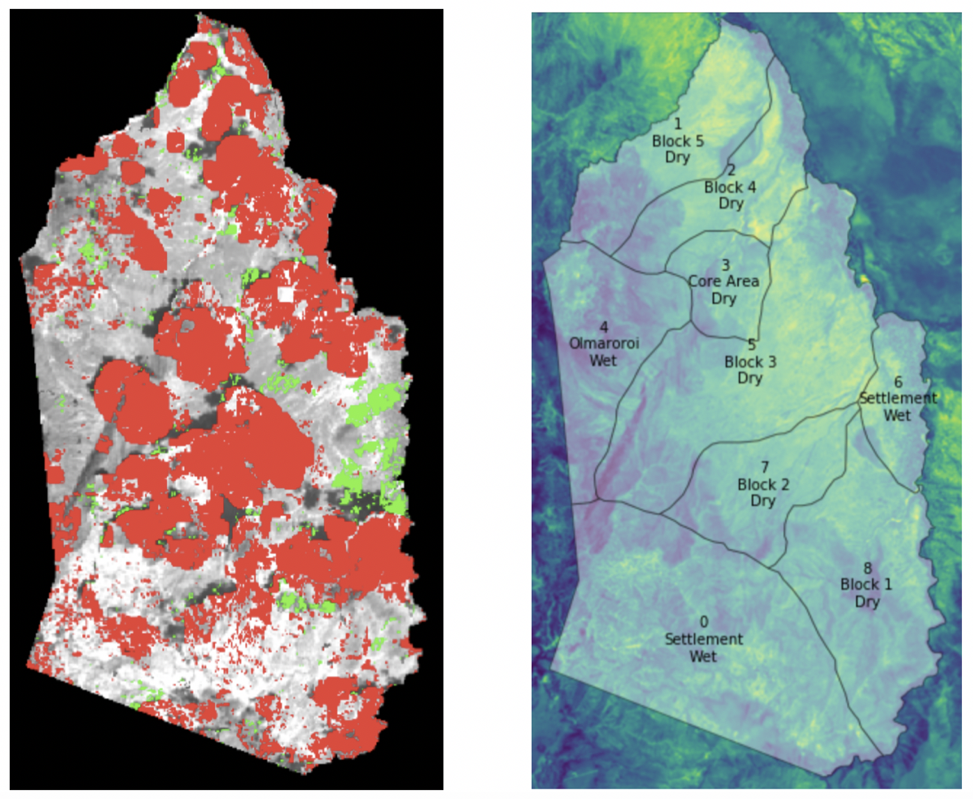
“Using remotely sensed estimates of Normalized Difference Vegetation Index (NDVI) we can see which of these grazing plots are losing vegetation, through fluctuating weather conditions or over-grazing, over time,” said Brian Killough, a researcher at NASA's Langley Research Center in Hampton, Virginia, who led the technical development of the ARDC.
"Using the data cube, the Il Ngwesi and Northern Rangelands Trust are able to observe and anticipate trends in vegetation condition to identify plots most suitable for the rhinos and develop grazing plans to prevent decimation of the lands, which could impact the health of the people and animals using it."
